
A journey through maps, National Library of Scotland, 22 July 2016 to 2 April 2017
«You are Here» is an exhibition that challenges what we know about maps, how they are made and how we understand them.
The National Library of Scotland's exhibition demonstrates the versatility and beauty of maps, and the skill of the cartographers who created them. Maps are everywhere: on our phones, in our cars, on walls, bus stops and adverts. But how much do we really know about them? «You are Here» explores our world through maps, asking questions about how maps are made and how we understand them.
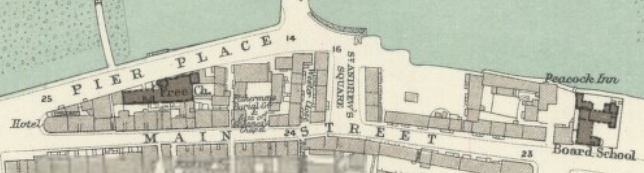
Exhibition visitors can wander through the maps on display, zooming out from the Library itself, to view the whole world. It includes one of the finest plans of Edinburgh, the first map of Scotland, as well as railway, fishing and schoolroom maps. You can explore:
The city of Edinburgh
The country of Scotland
The land of Great Britain
The continent of Europe
The whole world
L'occasion aussi de répondre à des questions telles que : pourquoi le nord est-il en haut ? Comment fait-on pour montrer des collines sur une carte plane ? Pourquoi une échelle ? etc. Pour le savoir, il faut aller à Edimbourg...
Pour tout savoir de cette exposition
«You are Here» is an exhibition that challenges what we know about maps, how they are made and how we understand them.
The National Library of Scotland's exhibition demonstrates the versatility and beauty of maps, and the skill of the cartographers who created them. Maps are everywhere: on our phones, in our cars, on walls, bus stops and adverts. But how much do we really know about them? «You are Here» explores our world through maps, asking questions about how maps are made and how we understand them.
Exhibition visitors can wander through the maps on display, zooming out from the Library itself, to view the whole world. It includes one of the finest plans of Edinburgh, the first map of Scotland, as well as railway, fishing and schoolroom maps. You can explore:
The city of Edinburgh
The country of Scotland
The land of Great Britain
The continent of Europe
The whole world
L'occasion aussi de répondre à des questions telles que : pourquoi le nord est-il en haut ? Comment fait-on pour montrer des collines sur une carte plane ? Pourquoi une échelle ? etc. Pour le savoir, il faut aller à Edimbourg...
Pour tout savoir de cette exposition