How to create (easily) a topographic map on the web ?
Finding and saving maps at various scales from the web. How come ?
Have you ever heard of « le GéoPortail » ?
Working since 2006, le Géoportail, is a french Google Earth run by the french cartographic institute (known as IGN). The monopolistic reference for french maps as added to its collection geographical data of the whole world, made by ESRI or OpenStreetMap. As they say about themselves :
[le GéoPortail] is now a complete infrastructure proposing its services to the citizens, public organisations or any kind of professional user.
Recipe for a perfect topographic PdF:
Cooking : between 5 minutes an 2 hours -depending on the quality of your broadband.
A computer
An access to Internet
Acrobat Reader
- Connect to Géoportail.
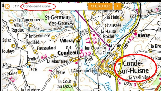
- Search the name of the place you want to make a map of.


Click here to continue reading this article
Finding and saving maps at various scales from the web. How come ?
Have you ever heard of « le GéoPortail » ?
Working since 2006, le Géoportail, is a french Google Earth run by the french cartographic institute (known as IGN). The monopolistic reference for french maps as added to its collection geographical data of the whole world, made by ESRI or OpenStreetMap. As they say about themselves :
[le GéoPortail] is now a complete infrastructure proposing its services to the citizens, public organisations or any kind of professional user.
Recipe for a perfect topographic PdF:
Cooking : between 5 minutes an 2 hours -depending on the quality of your broadband.
A computer
An access to Internet
Acrobat Reader
- Connect to Géoportail.
- Search the name of the place you want to make a map of.


Click here to continue reading this article
