
Cartes : numérisées
Catalogue des cartes numérisées - Liste de toutes les cartes
Katalog der gelisteten Karten - Liste aller Karten

Catalogo de mapas numéricos - Lista de todos mapas
Catalogo delle carte numerizzate - Lista di tutte le carte
Catalogue of digitized maps - Show list of all maps
Numérikus térképek katalogusa - Az osszes térkepek listaja
Catalogul cartilor numerizate - Lista cartilor
 Cliquez sur
  pour voir la carte
Klicken auf um die Karte zu sehen /
 / Pinchar aqui para ver el mapa / Clicca su per visualizzare la carta / Click on to see the map / Kattints hogy lasd a térképet
Voir les 12 résultats suivants...
Catalogue des cartes numérisées - Liste de toutes les cartes
Katalog der gelisteten Karten - Liste aller Karten
Catalogo de mapas numéricos - Lista de todos mapas
Catalogo delle carte numerizzate - Lista di tutte le carte
Catalogue of digitized maps - Show list of all maps
Numérikus térképek katalogusa - Az osszes térkepek listaja
Catalogul cartilor numerizate - Lista cartilor
pour voir la carteKlicken auf
um die Karte zu sehen / / Pinchar aqui para ver el mapa / Clicca su per visualizzare la carta / Click on to see the map / Kattints hogy lasd a térképet
| Voir | Titre | Titre de feuille | Editeur | Date | Echelle | Coordonnées | Pays |
|---|---|---|---|---|---|---|---|
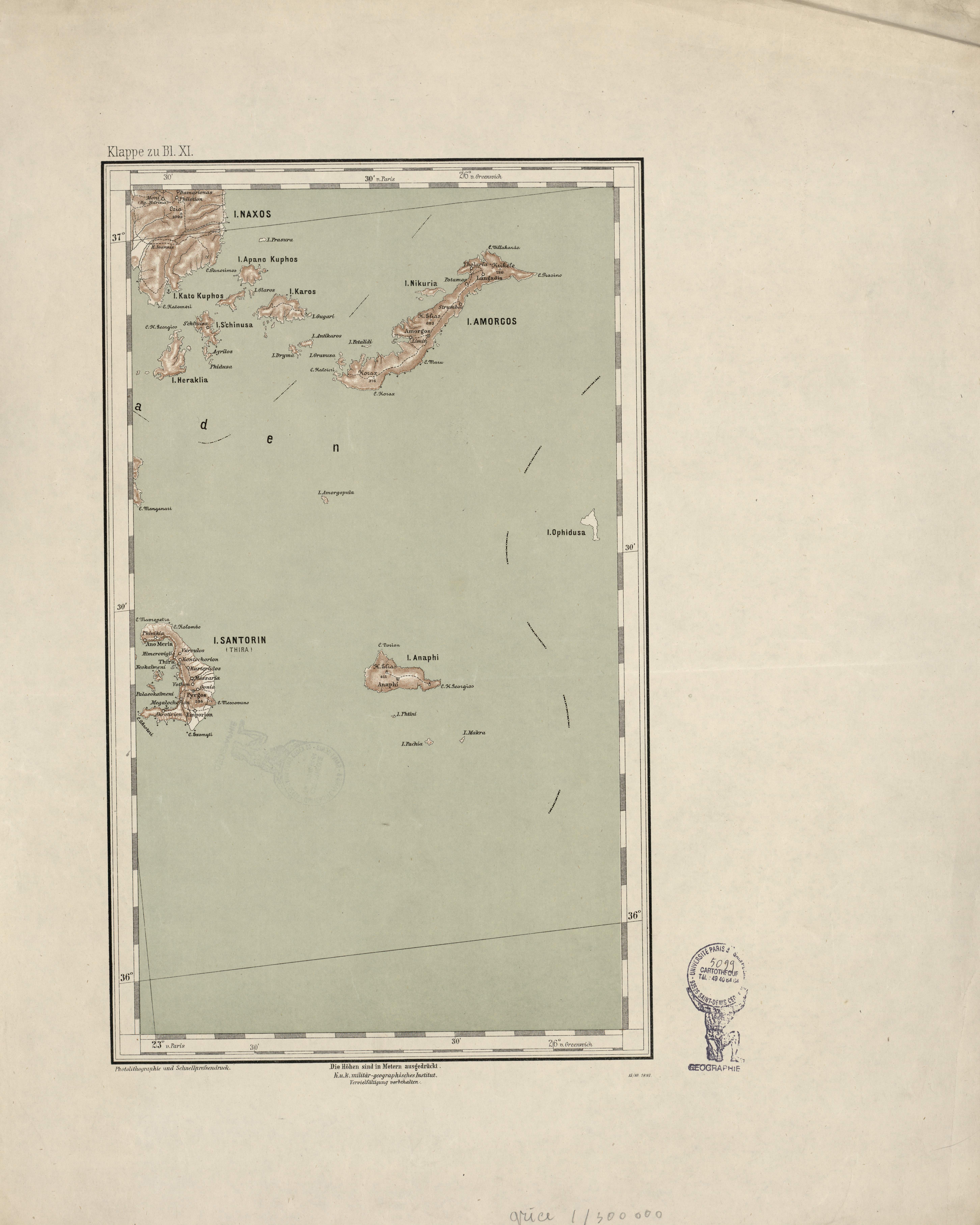
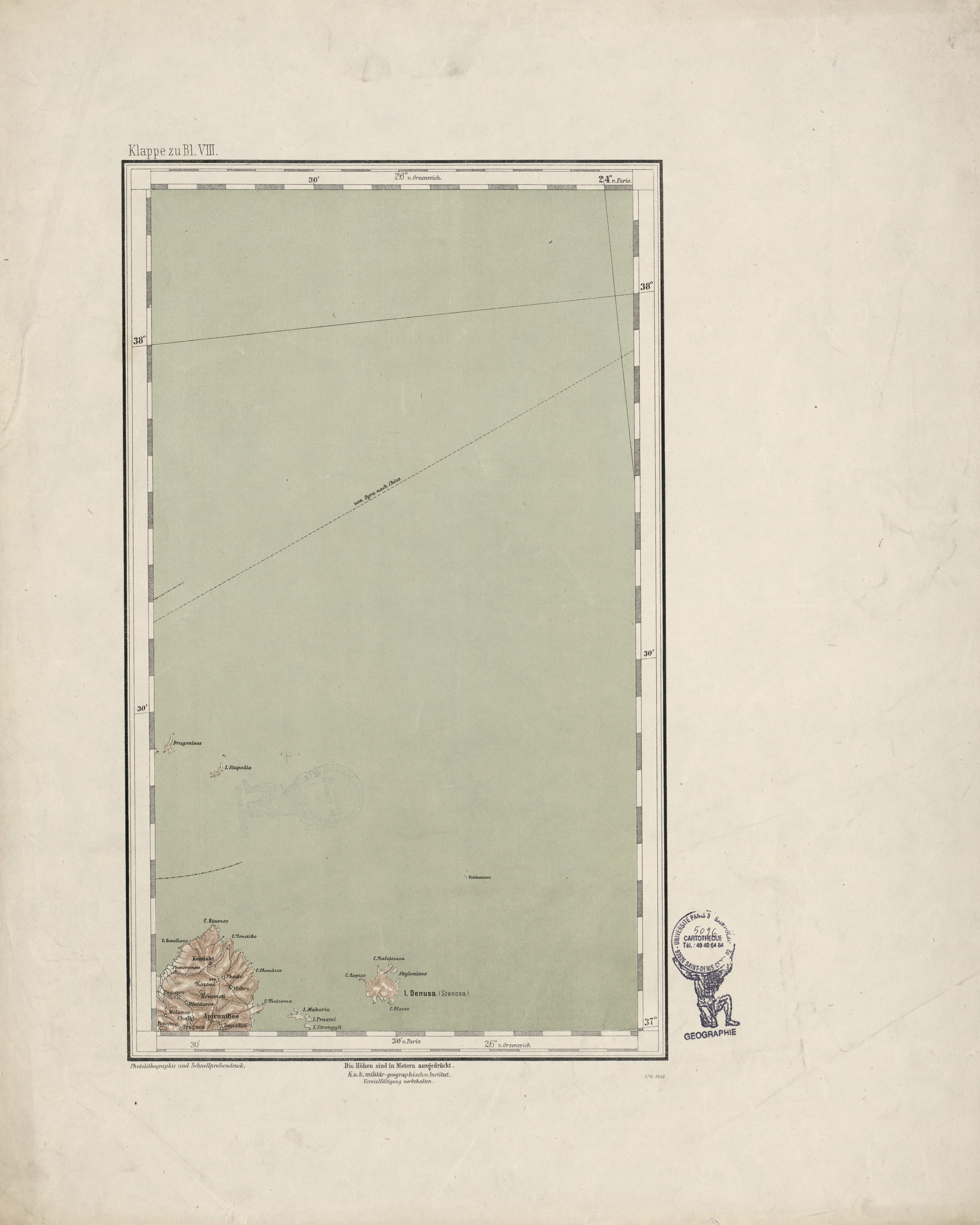 | General-Karte des Königreiches Griechenland im Masse 1:300 000 der Natur | [Denusa = Stenosa ; île] | K.K. Militär-Geographischen Institut | 1897 | 1:300 000 | Klappe zu B1.VIII | Grèce |
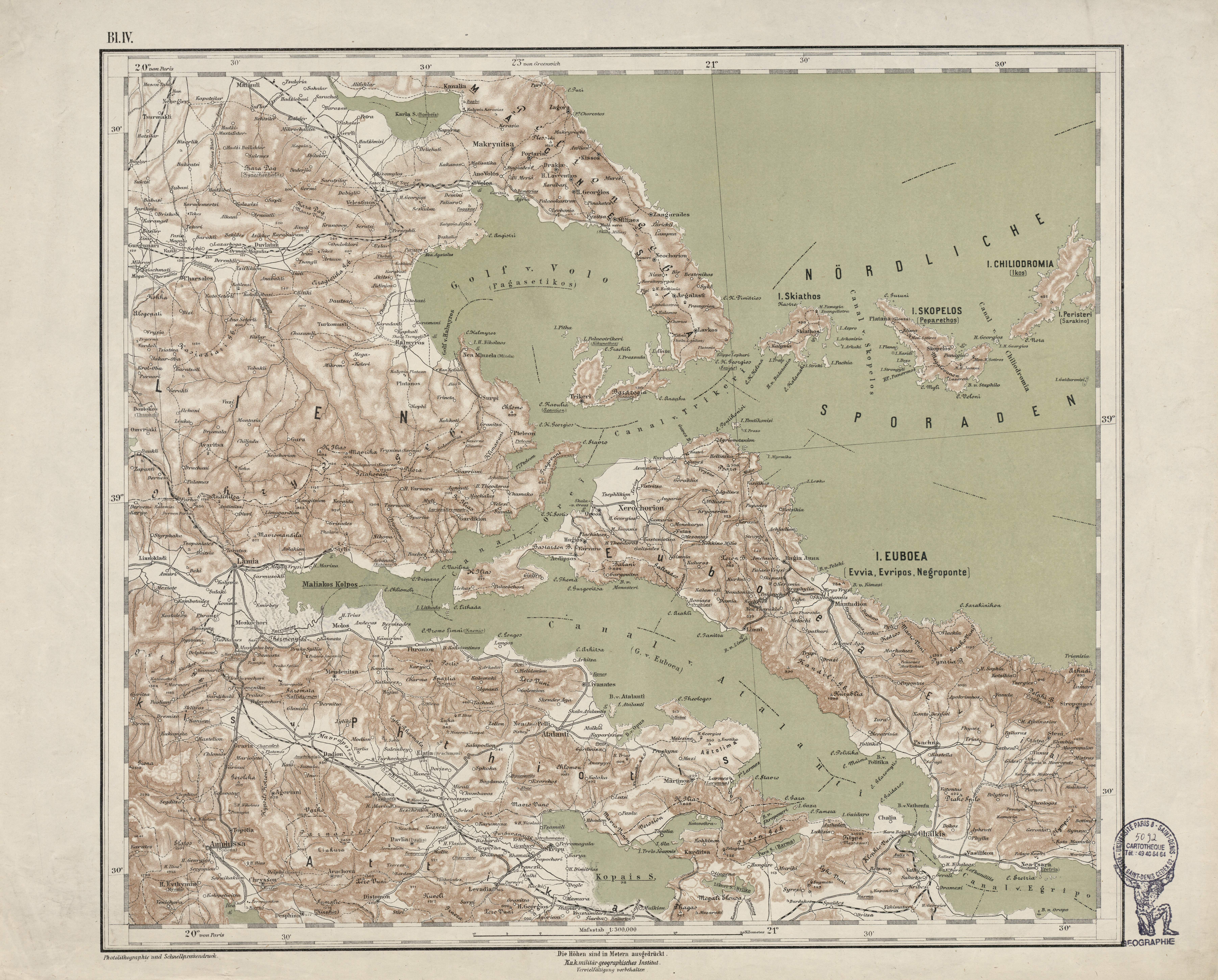 | General-Karte des Königreiches Griechenland im Masse 1:300 000 der Natur | [Euboea = Evvia = Evripos = Eubée ; île] | K.K. Militär-Geographischen Institut | 1885 | 1:300 000 | B1.IV | Grèce |
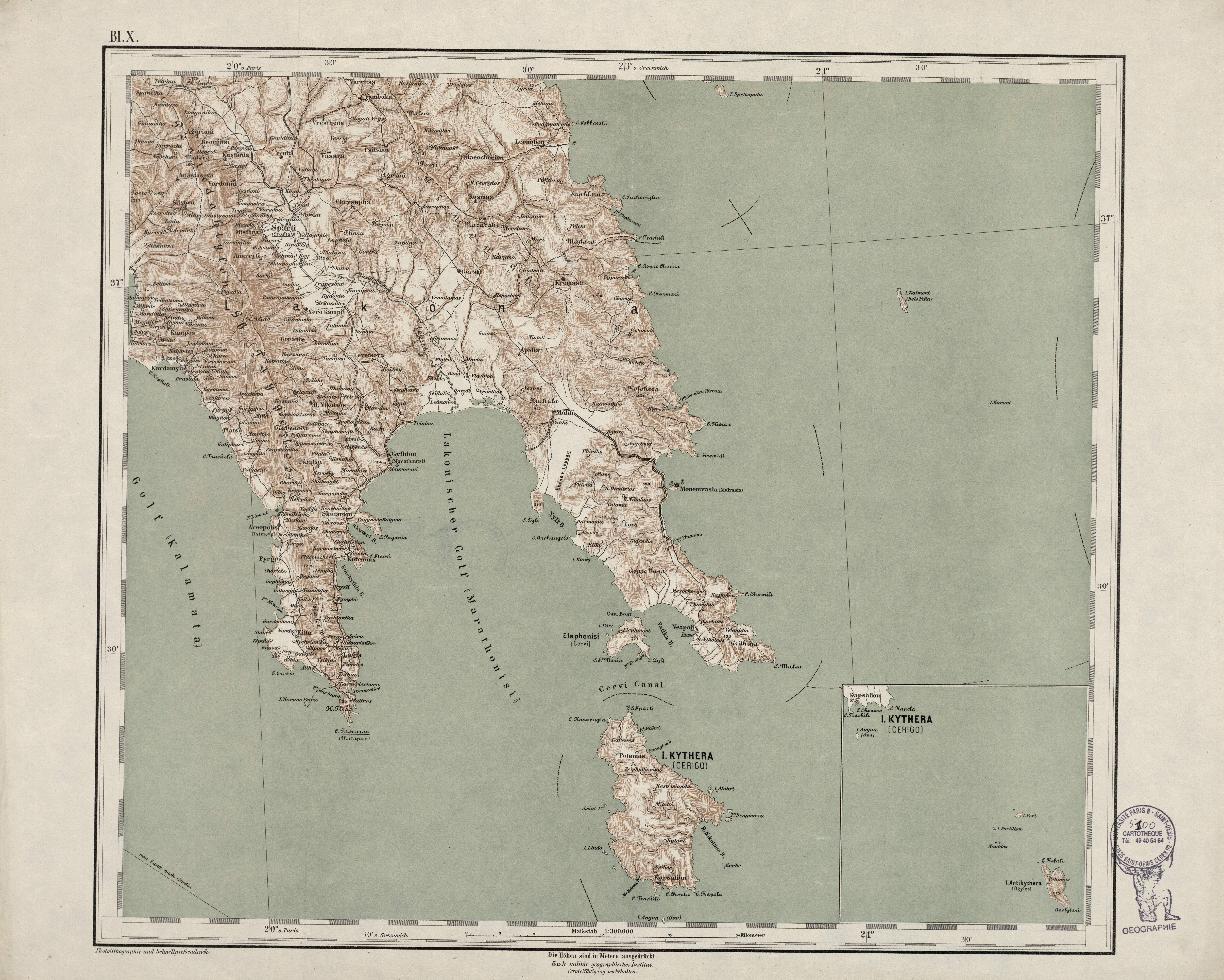 | General-Karte des Königreiches Griechenland im Masse 1:300 000 der Natur | [Kythera = Cerigo ; île] | K.K. Militär-Geographischen Institut | [1885] | 1:300 000 | B1.X | Grèce |
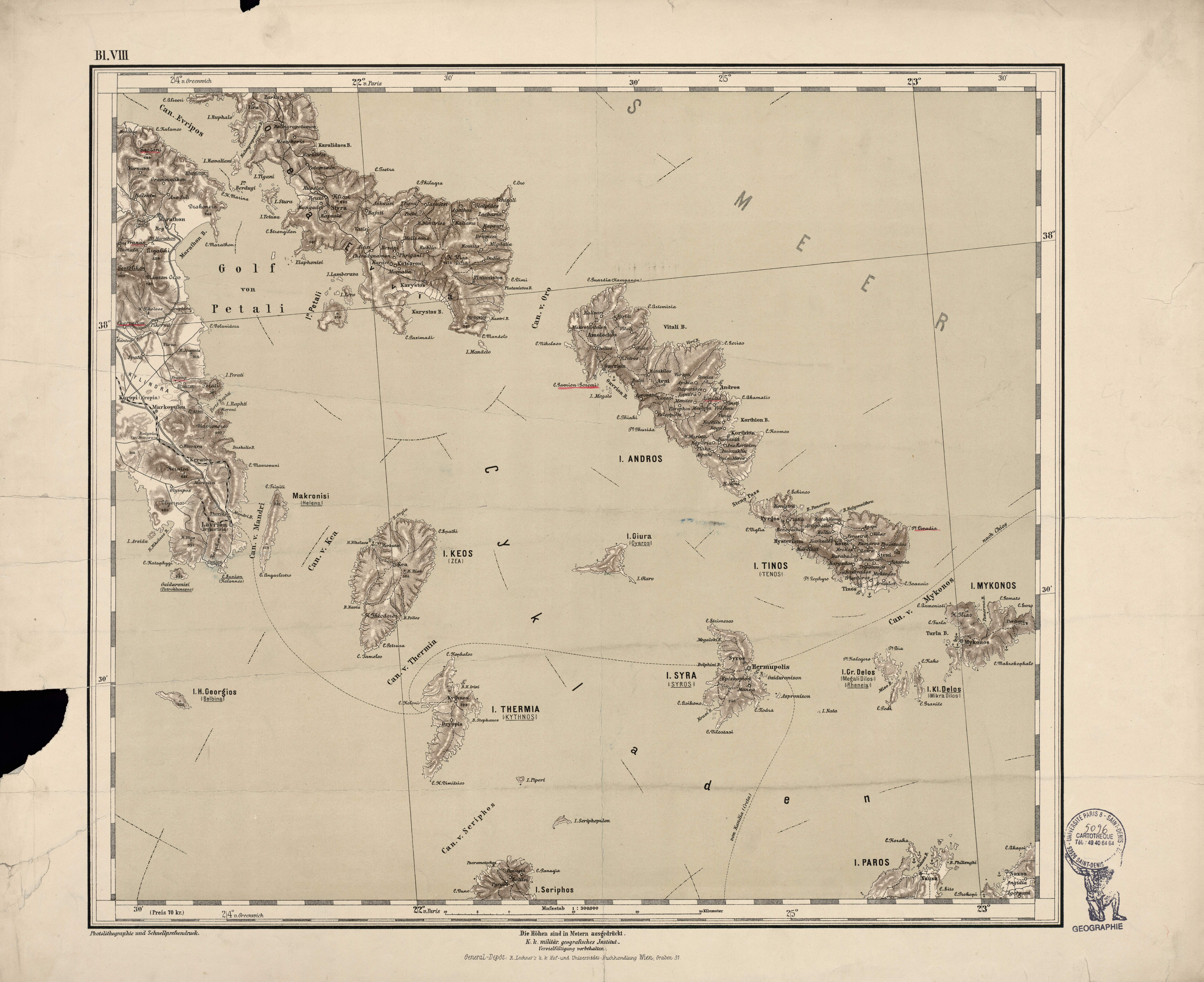 | General-Karte des Königreiches Griechenland im Masse 1:300 000 der Natur | [Mykonos ; île] | K.K. Militär-Geographischen Institut | 1885 | 1:300 000 | B1.VIII | Grèce |
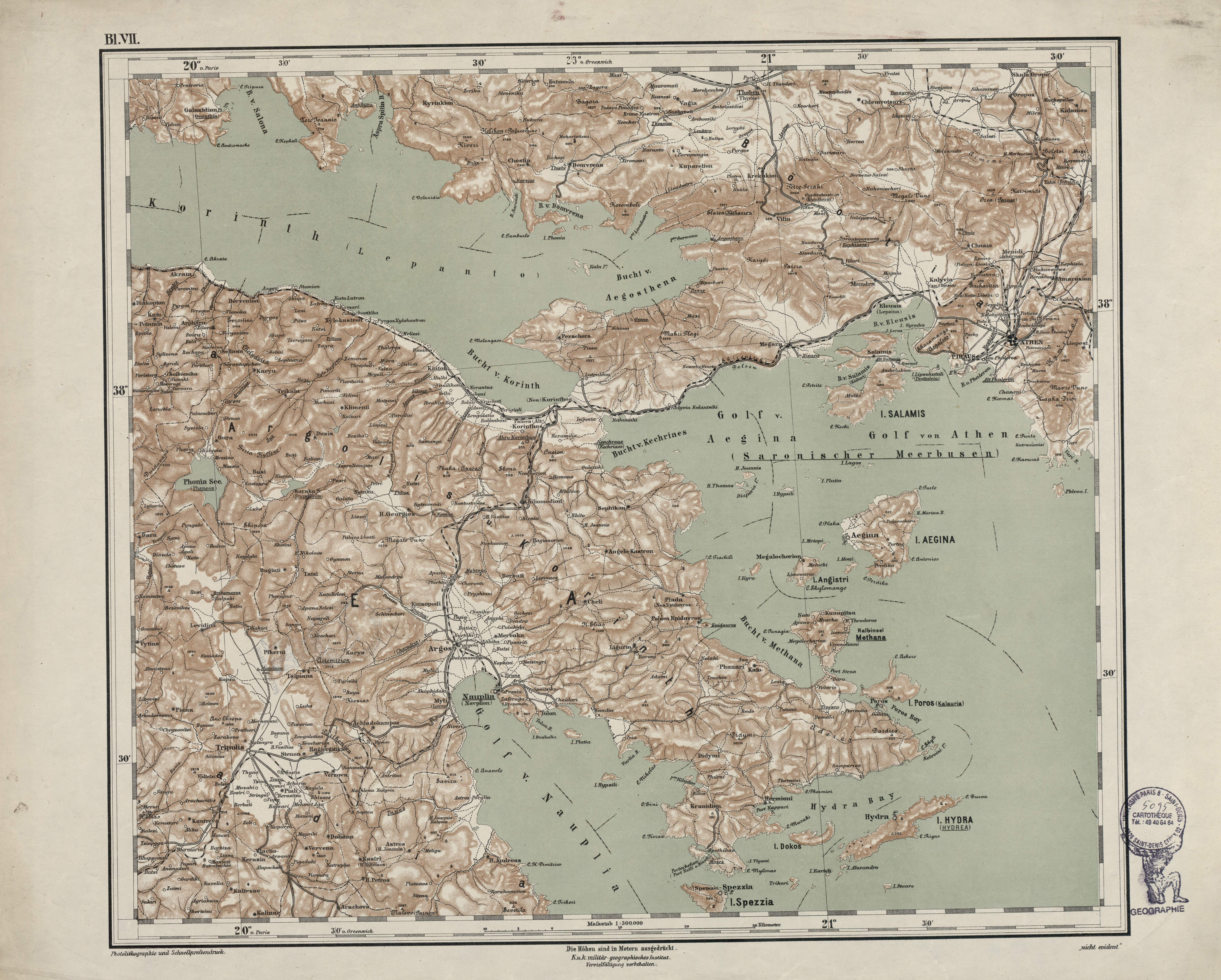 | General-Karte des Königreiches Griechenland im Masse 1:300 000 der Natur | [Salamis ; île] | K.K. Militär-Geographischen Institut | 1885 | 1:300 000 | B1.VII | Grèce |
 | General-Karte des Königreiches Griechenland im Masse 1:300 000 der Natur | [Santorin = Thira ; île] | K.K. Militär-Geographischen Institut | 1885 | 1:300 000 | Klappe zu B1.XI | Grèce |
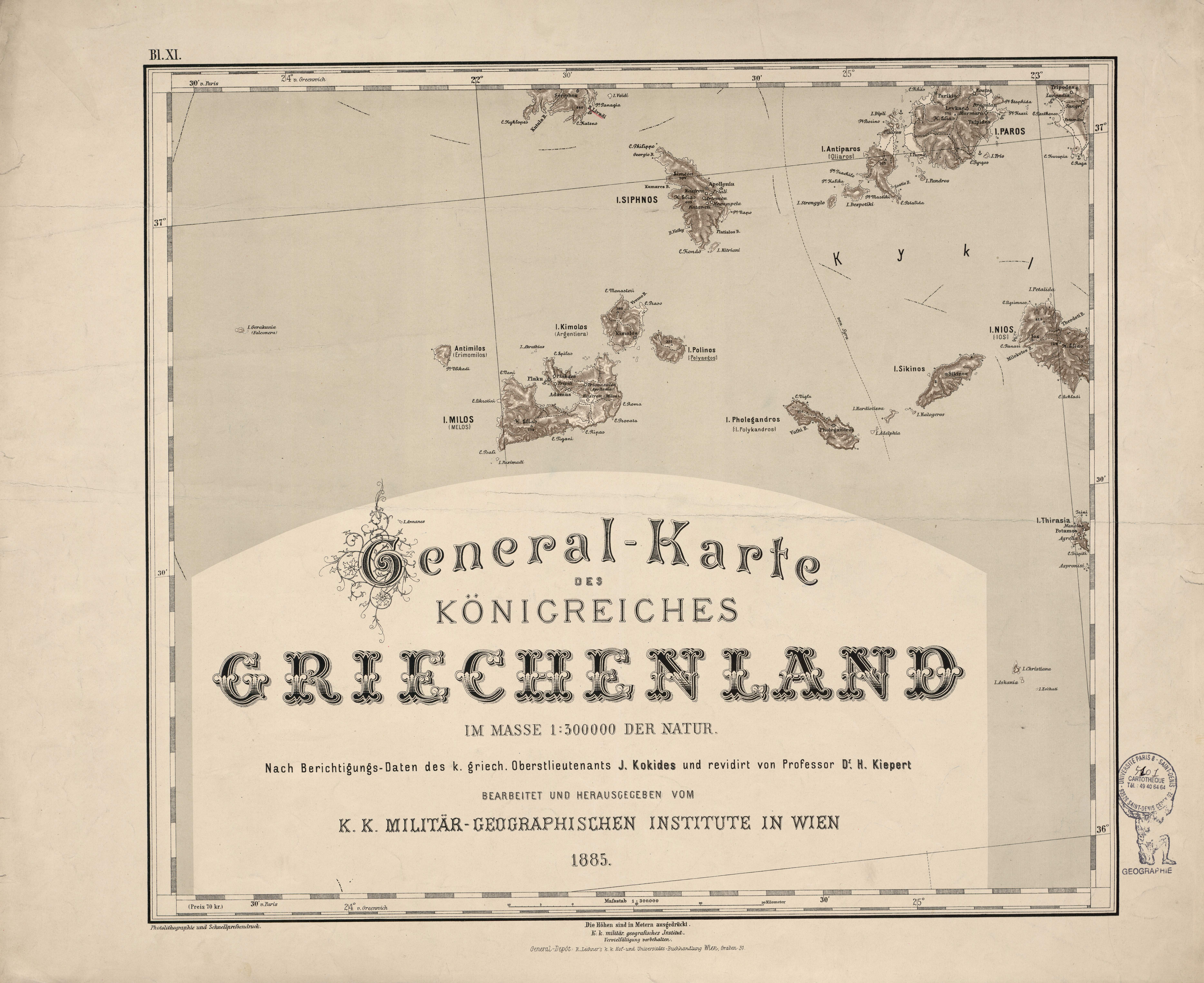 | General-Karte des Königreiches Griechenland im Masse 1:300 000 der Natur | [Siphnos ; île] | K.K. Militär-Geographischen Institut | 1885 | 1:300 000 | B1.XI | Grèce |
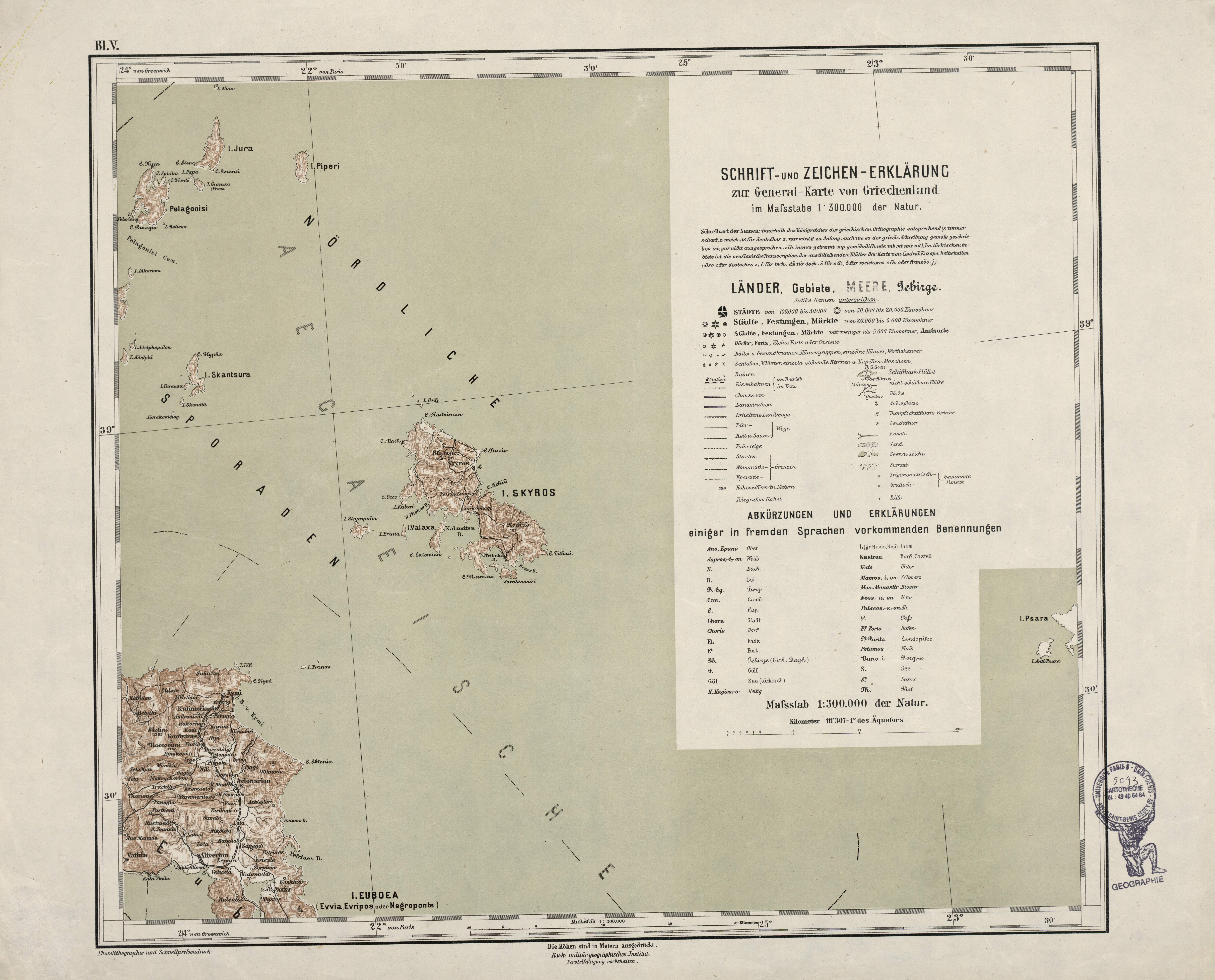 | General-Karte des Königreiches Griechenland im Masse 1:300 000 der Natur | [Skyros ; île] | K.K. Militär-Geographischen Institut | 1885 | 1:300 000 | B1.V | Grèce |
 | General-Karte des Königreiches Griechenland im Masse 1:300 000 der Natur | [St-Maura = Levkas ; île] | K.K. Militär-Geographischen Institut | 1885 | 1:300 000 | B1.III | Grèce |
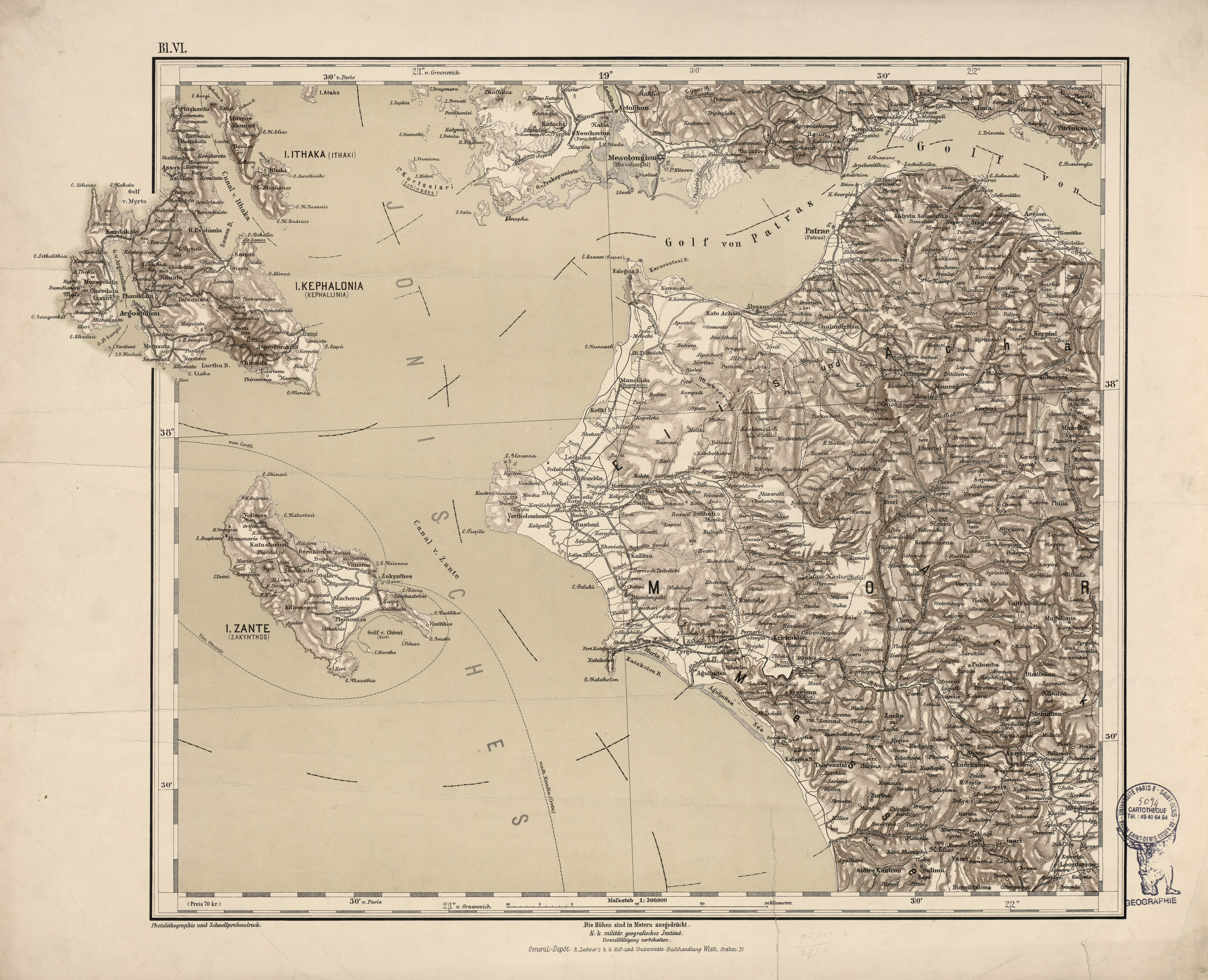 | General-Karte des Königreiches Griechenland im Masse 1:300 000 der Natur | [Zante = Zakynthos ; île] | K.K. Militär-Geographischen Institut | 1885 | 1:300 000 | B1.VI | Grèce |
| Generalkarte von Mitteleuropa | Adrianopel | K.u.k. Militärgeographisches Institut | 1903 | 1:200 000 | 44 42 | Turquie |
 | Generalkarte von Mitteleuropa | Alessandria | Militärgeographischen Institut | 1940 | 1:200 000 | 26 45 | Italie |
Voir les 12 résultats suivants...