
Cartes : numérisées
Catalogue des cartes numérisées - Liste de toutes les cartes
Katalog der gelisteten Karten - Liste aller Karten

Catalogo de mapas numéricos - Lista de todos mapas
Catalogo delle carte numerizzate - Lista di tutte le carte
Catalogue of digitized maps - Show list of all maps
Numérikus térképek katalogusa - Az osszes térkepek listaja
Catalogul cartilor numerizate - Lista cartilor
 Cliquez sur
  pour voir la carte
Klicken auf um die Karte zu sehen /
 / Pinchar aqui para ver el mapa / Clicca su per visualizzare la carta / Click on to see the map / Kattints hogy lasd a térképet
Voir les 12 résultats suivants...
Catalogue des cartes numérisées - Liste de toutes les cartes
Katalog der gelisteten Karten - Liste aller Karten
Catalogo de mapas numéricos - Lista de todos mapas
Catalogo delle carte numerizzate - Lista di tutte le carte
Catalogue of digitized maps - Show list of all maps
Numérikus térképek katalogusa - Az osszes térkepek listaja
Catalogul cartilor numerizate - Lista cartilor
pour voir la carteKlicken auf
um die Karte zu sehen / / Pinchar aqui para ver el mapa / Clicca su per visualizzare la carta / Click on to see the map / Kattints hogy lasd a térképet
| Voir | Titre | Titre de feuille | Editeur | Date | Echelle | Coordonnées | Pays |
|---|---|---|---|---|---|---|---|
| Ubersichtskarte von Mitteleuropa | Rouen | [s.n.] | 1940 | 1:300 000 | G.50 | France |
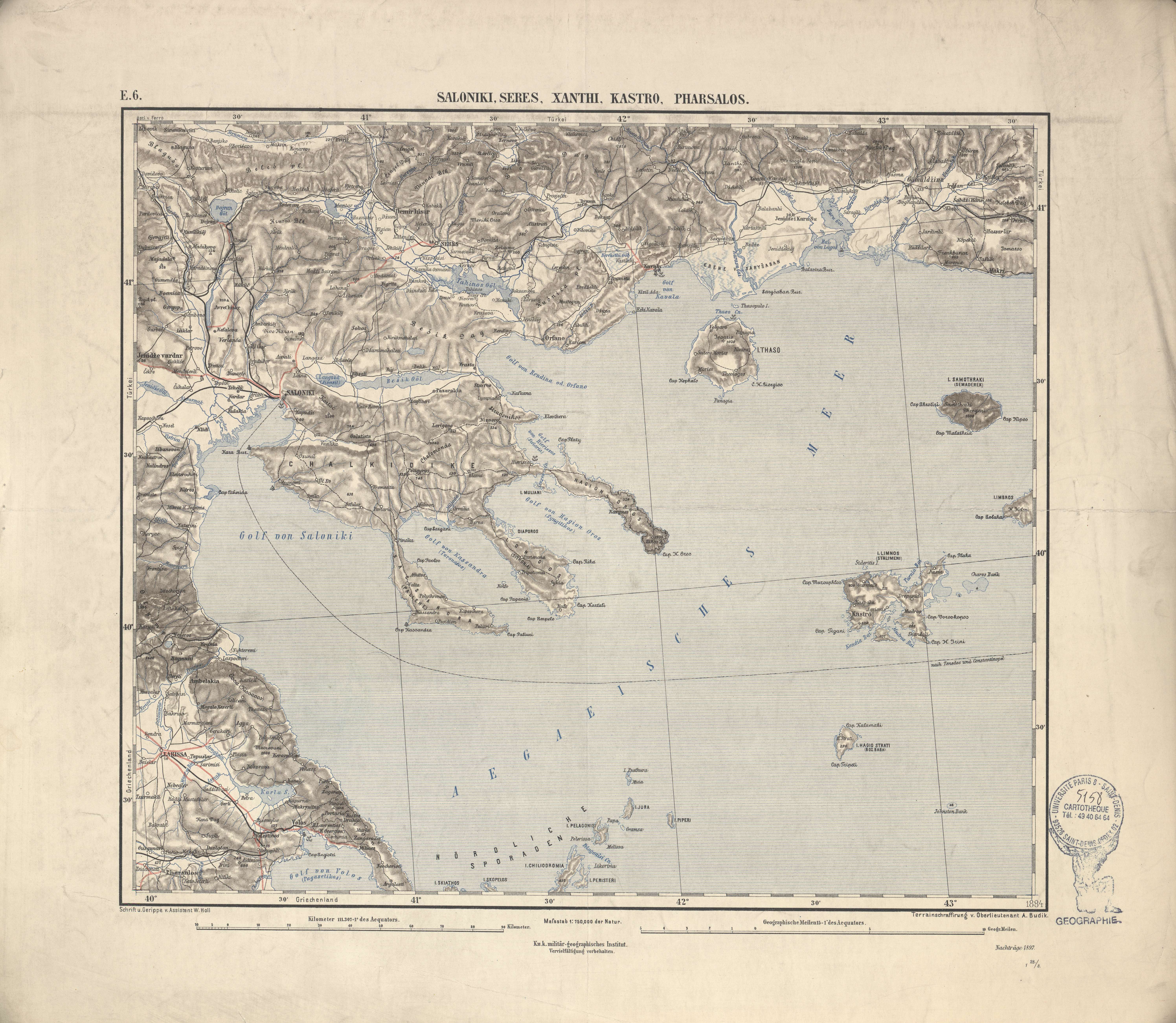 | Ubersichtskarte von Mitteleuropa | Saloniki, Seres, Xanthi, Kastro, Pharsalos | K.u.k. Militärgeographisches Institut | 1897 | 1:750 000 | E.6 | Grèce |
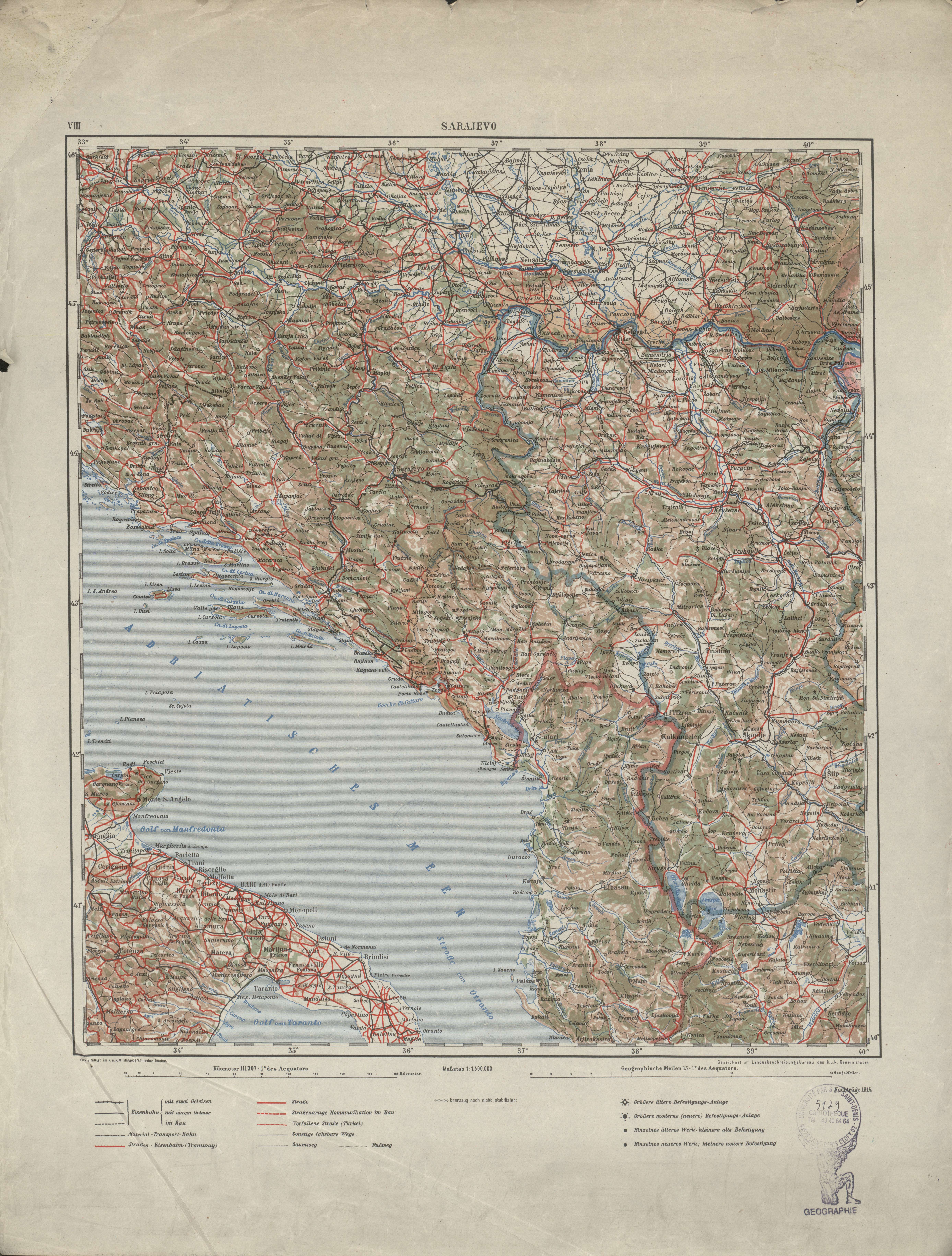 | Ubersichtskarte von Mitteleuropa | Sarajevo | K.u.k. Militärgeographisches Institut | 1914 | 1:1 500 000 | VIII | Bosnie-Herzégovine |
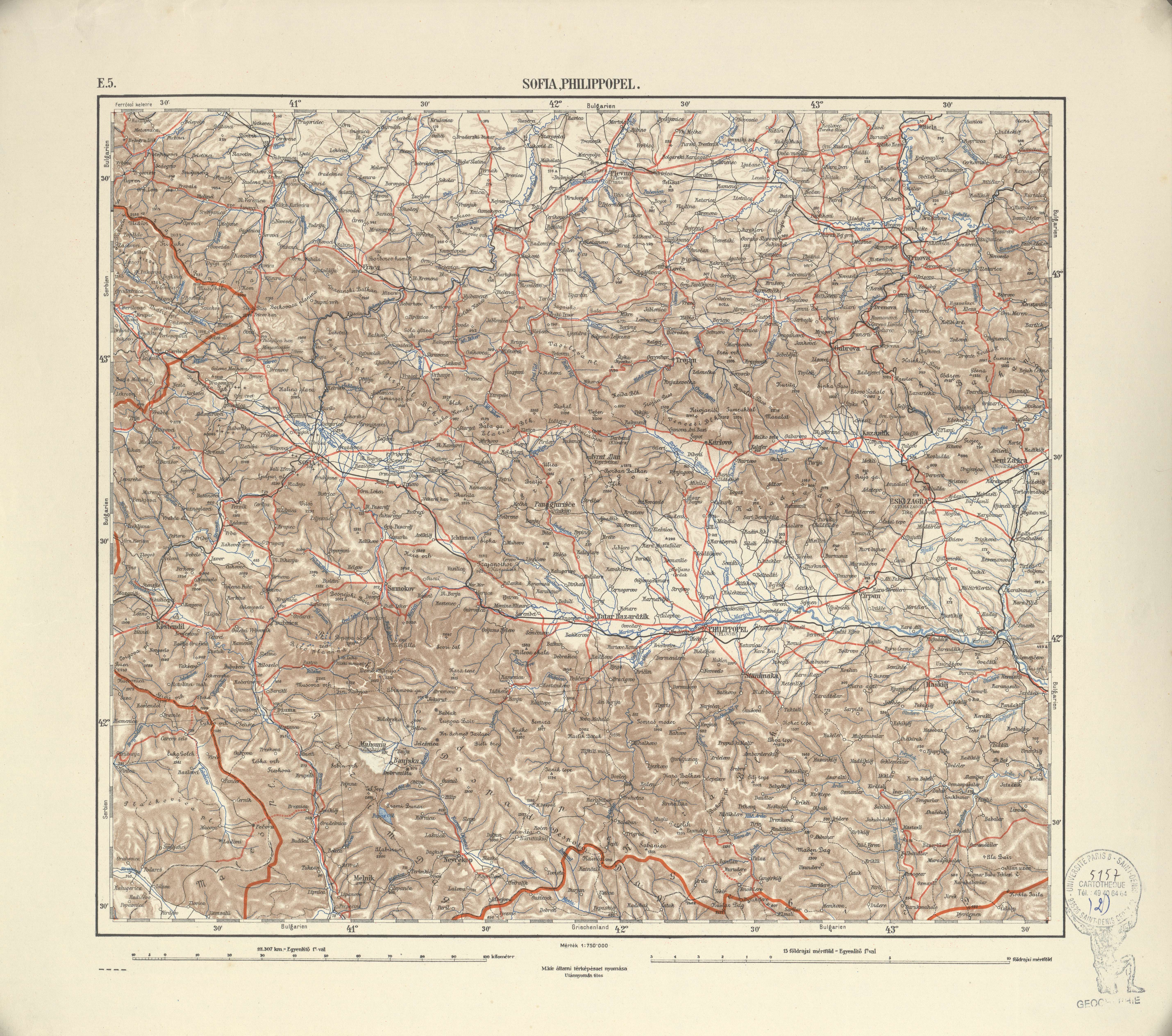 | Ubersichtskarte von Mitteleuropa | Sofia, Philippopel | M.kir allami terkepeszet nyomasa | [s.d.] | 1:750 000 | E.5 | Bulgarie |
| Ubersichtskarte von Mitteleuropa | Stettin | Reichsamt für Landesaufnahme | 1938 | 1:300 000 | O.54 | Pologne |
| Ubersichtskarte von Mitteleuropa | Stolp | [s.n.] | 1938 | 1:300 000 | P.55 | Pologne |
| Ubersichtskarte von Mitteleuropa | Strassburg | [s.n.] | 1940 | 1:300 000 | K.49 | France |
 | Ubersichtskarte von Mitteleuropa | Szeged és Debrecen | M.kir. allami térképészet | [s.d.] | 1:750 000 | D.3 | Hongrie |
| Ubersichtskarte von Mitteleuropa | Szegedin | HVA.XIV | 1944 | 1:300 000 | Q.47 | Hongrie |
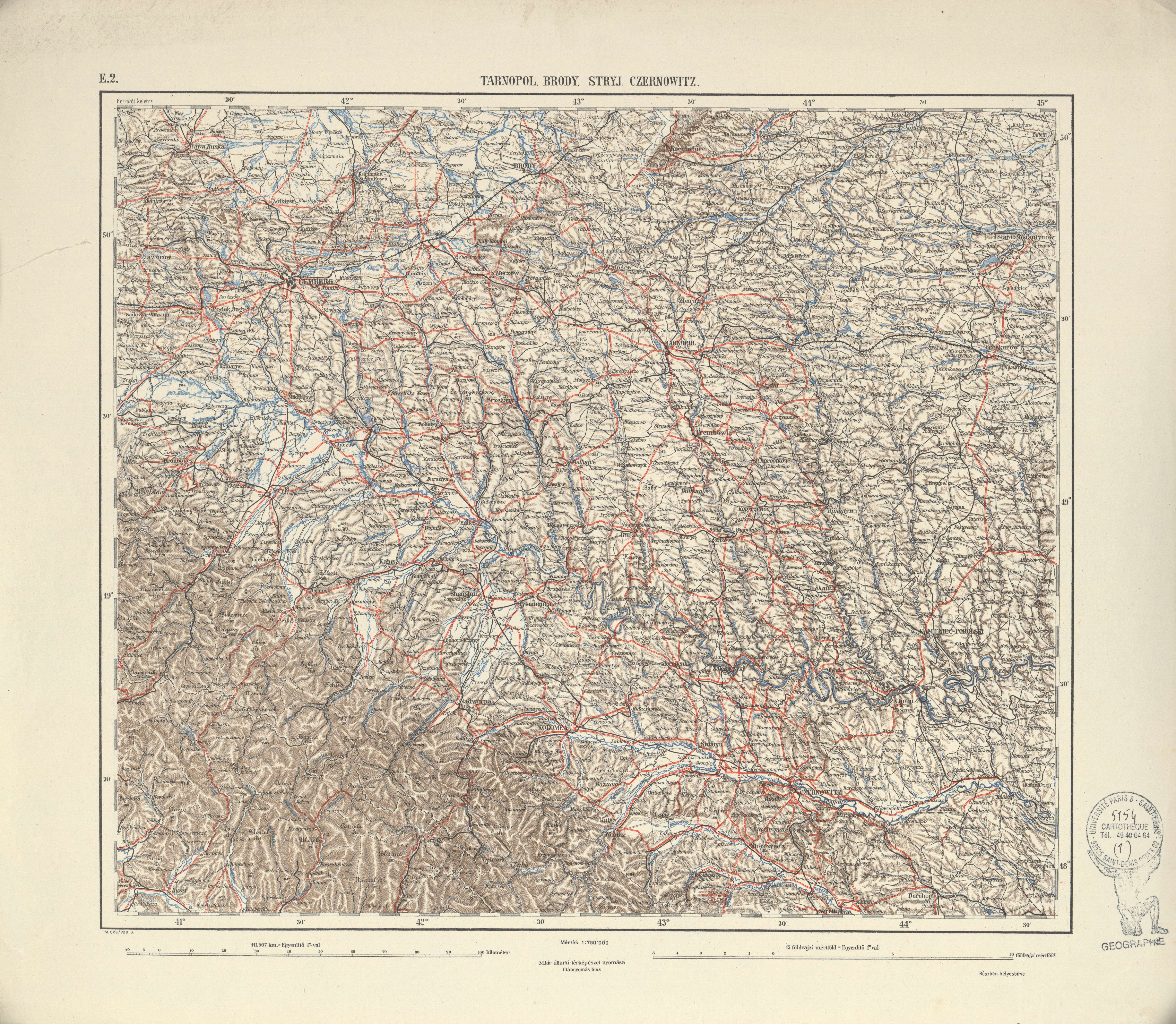 | Ubersichtskarte von Mitteleuropa | Tarnopol, Brody, Stryj, Czernowitz | M.kir allami tèrkèpèszet nyomasa | [s.d.] | 1:750 000 | E.2 | Ukraine |
| Ubersichtskarte von Mitteleuropa | Trier | [s.n.] | 1940 | 1:300 000 | K.50 | Allemagne |
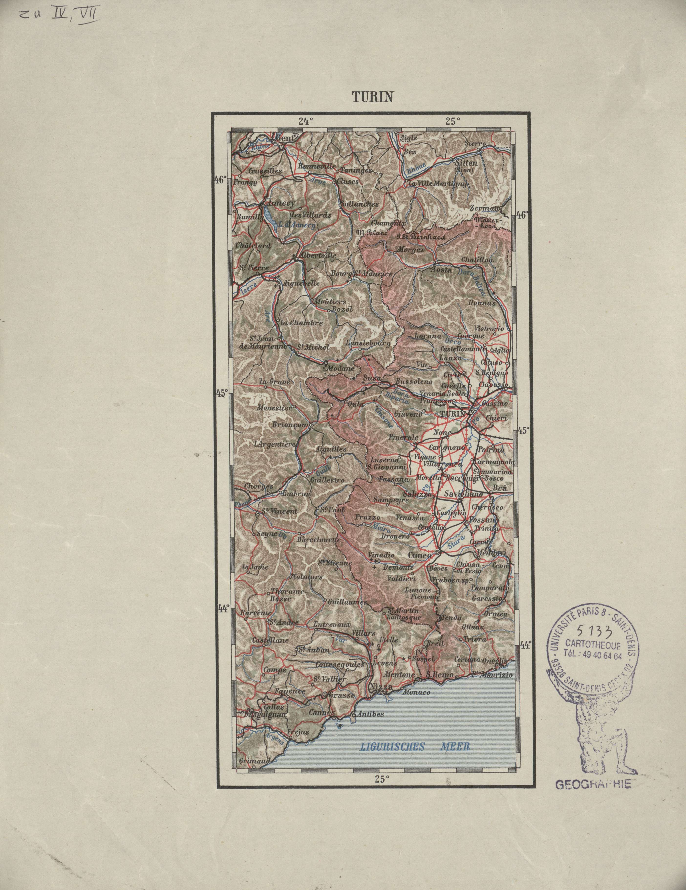 | Ubersichtskarte von Mitteleuropa | Turin | K.u.k. Militärgeographisches Institut | [s.d.] | 1:1 500 000 | IV, VII | Italie |
Voir les 12 résultats suivants...