
Cartes : numérisées
Catalogue des cartes numérisées - Liste de toutes les cartes
Katalog der gelisteten Karten - Liste aller Karten

Catalogo de mapas numéricos - Lista de todos mapas
Catalogo delle carte numerizzate - Lista di tutte le carte
Catalogue of digitized maps - Show list of all maps
Numérikus térképek katalogusa - Az osszes térkepek listaja
Catalogul cartilor numerizate - Lista cartilor
 Cliquez sur
  pour voir la carte
Klicken auf um die Karte zu sehen /
 / Pinchar aqui para ver el mapa / Clicca su per visualizzare la carta / Click on to see the map / Kattints hogy lasd a térképet
Voir les 12 résultats suivants...
Catalogue des cartes numérisées - Liste de toutes les cartes
Katalog der gelisteten Karten - Liste aller Karten
Catalogo de mapas numéricos - Lista de todos mapas
Catalogo delle carte numerizzate - Lista di tutte le carte
Catalogue of digitized maps - Show list of all maps
Numérikus térképek katalogusa - Az osszes térkepek listaja
Catalogul cartilor numerizate - Lista cartilor
pour voir la carteKlicken auf
um die Karte zu sehen / / Pinchar aqui para ver el mapa / Clicca su per visualizzare la carta / Click on to see the map / Kattints hogy lasd a térképet
| Voir | Titre | Titre de feuille | Editeur | Date | Echelle | Coordonnées | Pays |
|---|---|---|---|---|---|---|---|
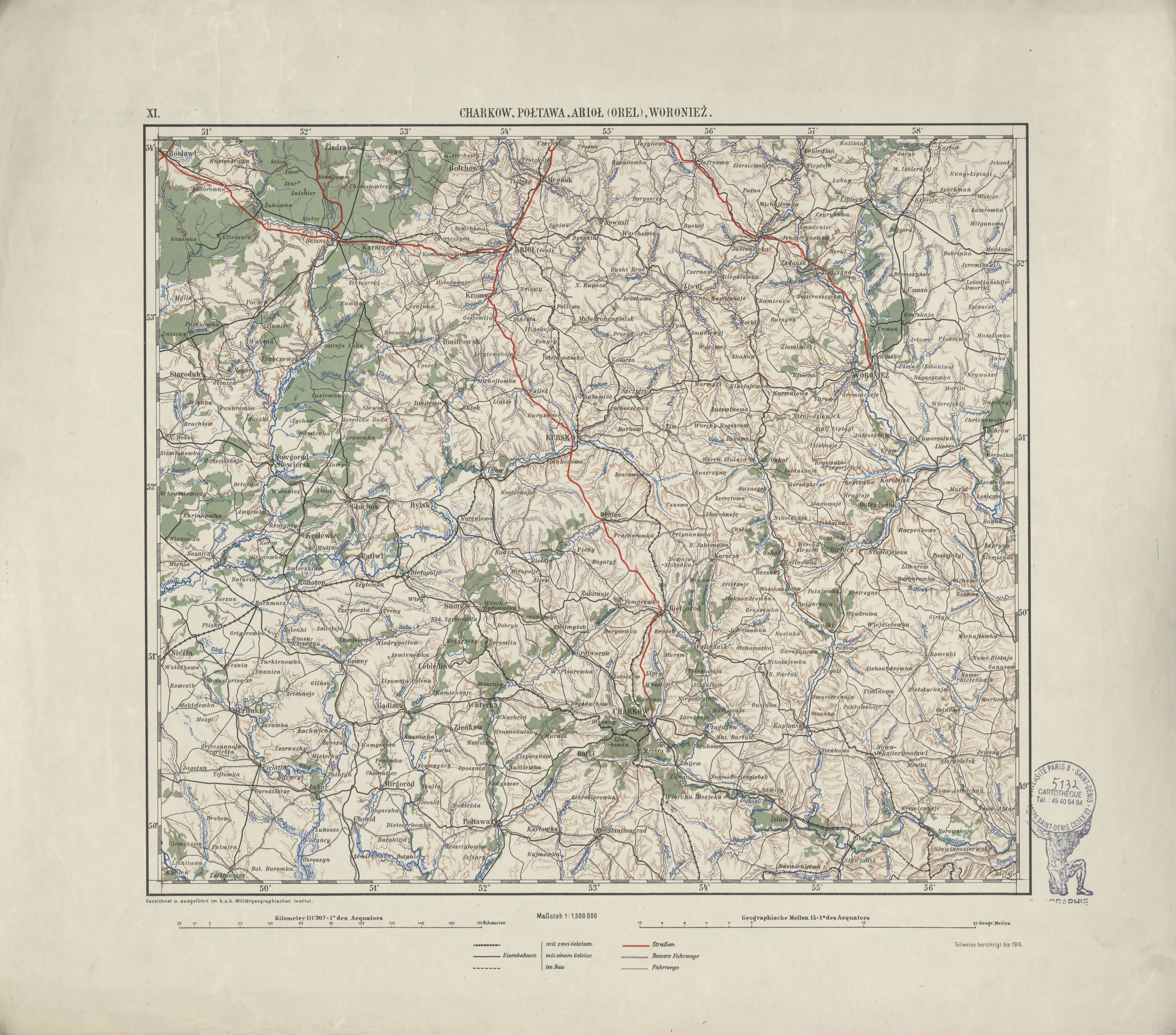 | Ubersichtskarte von Mitteleuropa | Charkow, Poltawa, Ariol (Orel), Woroniez | K.u.k. Militärgeographisches Institut | 1916 | 1:1 500 000 | XI | Ukraine |
| Ubersichtskarte von Mitteleuropa | Châteauroux | [s.n.] | 1940 | 1:300 000 | G.47 | France |
| Ubersichtskarte von Mitteleuropa | Cilli | [s.n.] | 1937 | 1:300 000 | O.47 | Slovénie |
| Ubersichtskarte von Mitteleuropa | Danzig | Reichsamt für Landesaufnahme | 1935 | 1:300 000 | Q.55 | Pologne |
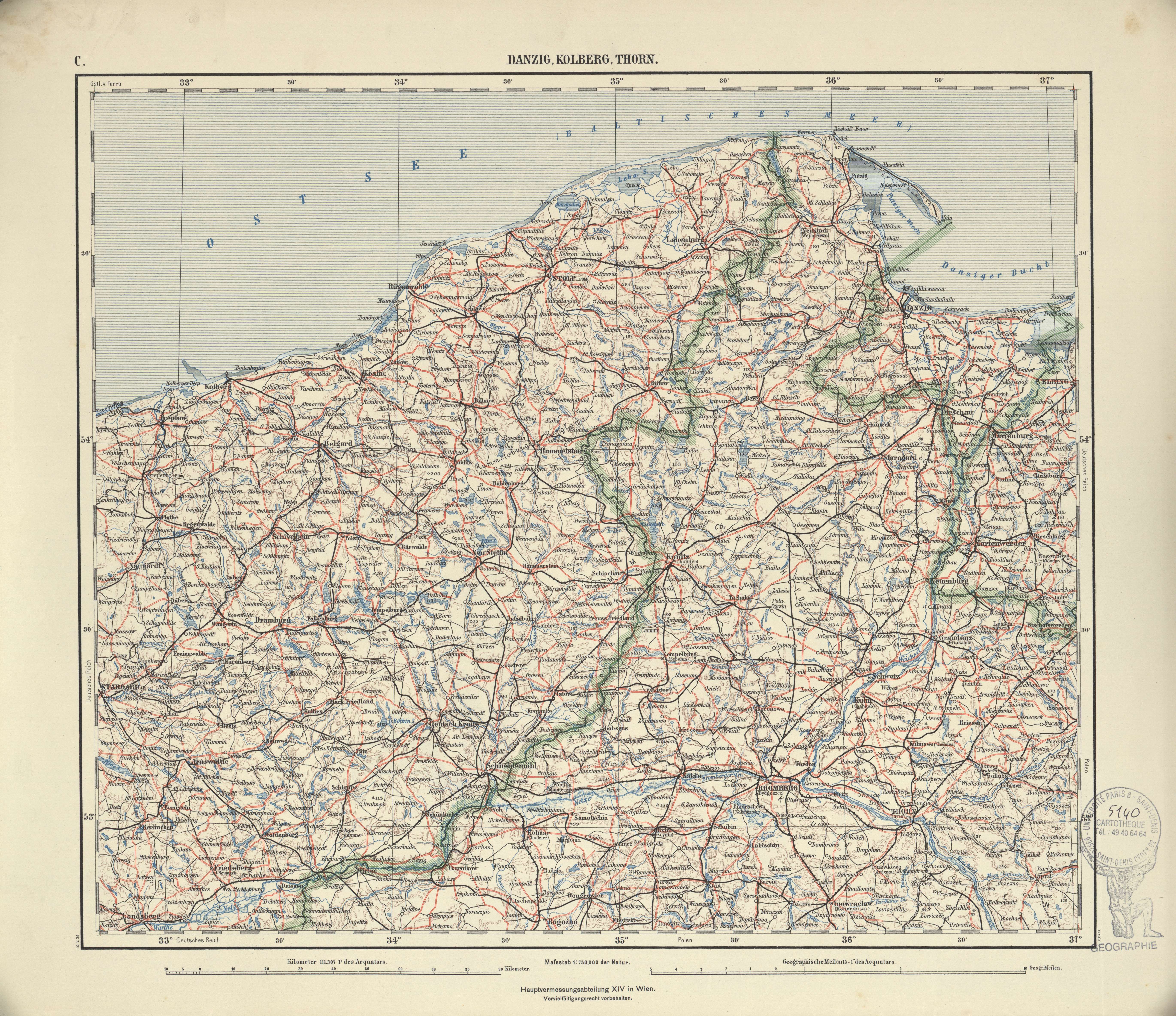 | Ubersichtskarte von Mitteleuropa | Danzig, Kolberg, Thorn | Hauptvermessungsabteilung XIV | 1939 | 1:750 000 | C | Pologne |
| Ubersichtskarte von Mitteleuropa | Darmstadt | Reichsamt für Landesaufnahme | 1936 | 1:300 000 | L.50 | Allemagne |
| Ubersichtskarte von Mitteleuropa | Debrezin | Reichsamt für Landesaufnahme | 1940 | 1:300 000 | R.48 | Hongrie |
| Ubersichtskarte von Mitteleuropa | Dombrowica | [s.n.] | 1938 | 1:300 000 | U.52 | Ukraine |
| Ubersichtskarte von Mitteleuropa | Dresden | Reichsamt für Landesaufnahme | 1932 | 1:300 000 | N.52 | Allemagne |
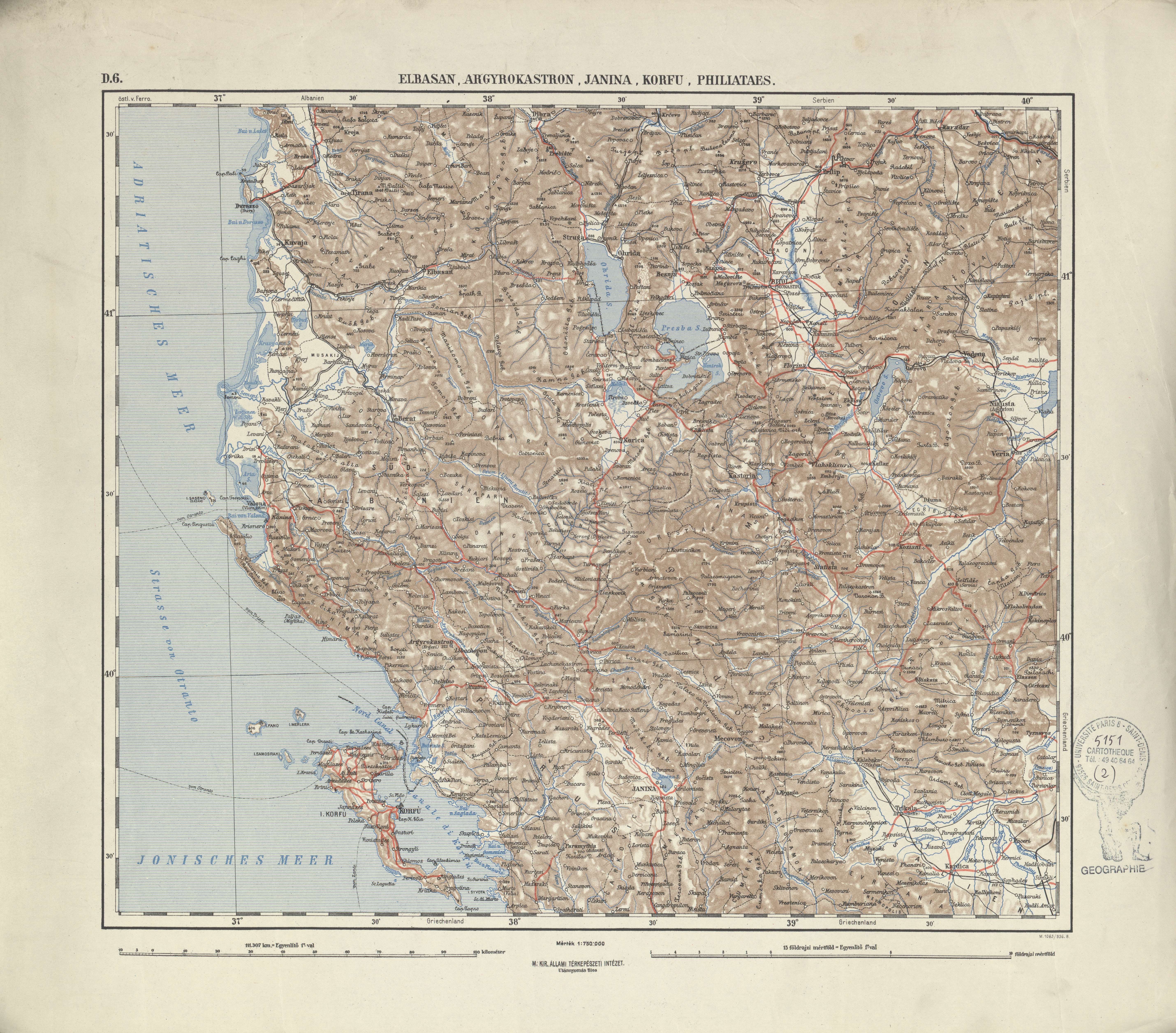 | Ubersichtskarte von Mitteleuropa | Elbasan, Argyrokastron, Janina, Korfu, Philiataes | M.kir allami térkepészeti intézet | [s.d.] | 1:750 000 | D.6 | Albanie |
| Ubersichtskarte von Mitteleuropa | Erfurt | Reichsamt für Landesaufnahme | 1932 | 1:300 000 | M.51 | Allemagne |
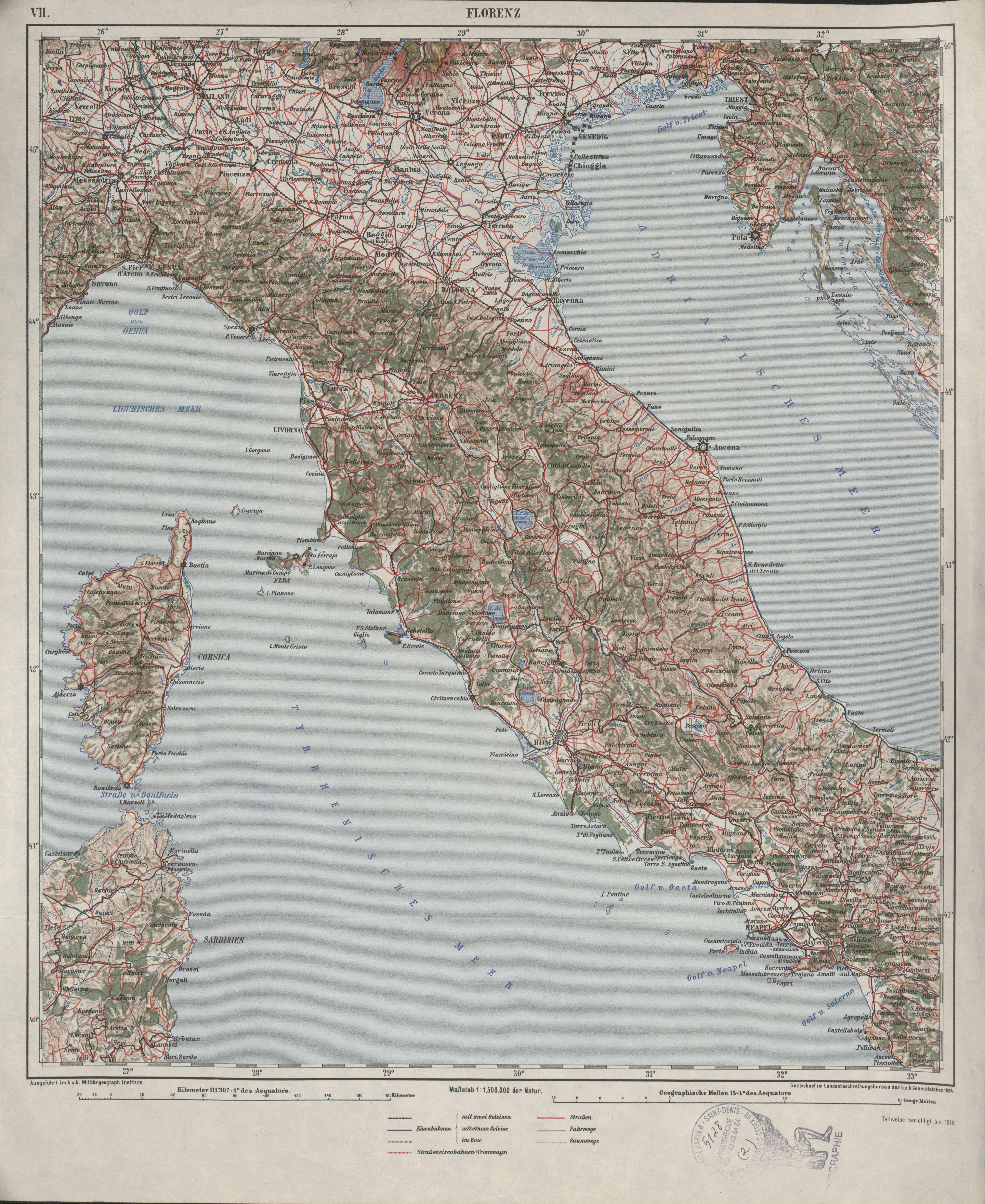 | Ubersichtskarte von Mitteleuropa | Florenz | K.u.k. Militärgeographisches Institut | 1916 | 1:1 500 000 | VII | Italie |
Voir les 12 résultats suivants...